Frozen: Ice On Earth And Well Beyond
Frozen: Ice on Earth and Well Beyond

Icy Hearts: A heart-shaped calving front of a glacier in Greenland (left) and Pluto's frozen plains (right). Credits: NASA/Maria-Jose Viñas and NASA/APL/SwRI
From deep below the soil at Earth’s polar regions to Pluto’s frozen heart, ice exists all over the solar system...and beyond. From right here on our home planet to moons and planets millions of miles away, we’re exploring ice and watching how it changes. Here’s 10 things to know:
1. Earth’s Changing Ice Sheets

An Antarctic ice sheet. Credit: NASA
Ice sheets are massive expanses of ice that stay frozen from year to year and cover more than 6 million square miles. On Earth, ice sheets extend across most of Greenland and Antarctica. These two ice sheets contain more than 99 percent of the planet’s freshwater ice. However, our ice sheets are sensitive to the changing climate.
Data from our GRACE satellites show that the land ice sheets in both Antarctica and Greenland have been losing mass since at least 2002, and the speed at which they’re losing mass is accelerating.
2. Sea Ice at Earth’s Poles

Earth’s polar oceans are covered by stretches of ice that freezes and melts with the seasons and moves with the wind and ocean currents. During the autumn and winter, the sea ice grows until it reaches an annual maximum extent, and then melts back to an annual minimum at the end of summer. Sea ice plays a crucial role in regulating climate – it’s much more reflective than the dark ocean water, reflecting up to 70 percent of sunlight back into space; in contrast, the ocean reflects only about 7 percent of the sunlight that reaches it. Sea ice also acts like an insulating blanket on top of the polar oceans, keeping the polar wintertime oceans warm and the atmosphere cool.
Some Arctic sea ice has survived multiple years of summer melt, but our research indicates there’s less and less of this older ice each year. The maximum and minimum extents are shrinking, too. Summertime sea ice in the Arctic Ocean now routinely covers about 30-40 percent less area than it did in the late 1970s, when near-continuous satellite observations began. These changes in sea ice conditions enhance the rate of warming in the Arctic, already in progress as more sunlight is absorbed by the ocean and more heat is put into the atmosphere from the ocean, all of which may ultimately affect global weather patterns.
3. Snow Cover on Earth

Snow extends the cryosphere from the poles and into more temperate regions.
Snow and ice cover most of Earth’s polar regions throughout the year, but the coverage at lower latitudes depends on the season and elevation. High-elevation landscapes such as the Tibetan Plateau and the Andes and Rocky Mountains maintain some snow cover almost year-round. In the Northern Hemisphere, snow cover is more variable and extensive than in the Southern Hemisphere.
Snow cover the most reflective surface on Earth and works like sea ice to help cool our climate. As it melts with the seasons, it provides drinking water to communities around the planet.
4. Permafrost on Earth

Tundra polygons on Alaska's North Slope. As permafrost thaws, this area is likely to be a source of atmospheric carbon before 2100. Credit: NASA/JPL-Caltech/Charles Miller
Permafrost is soil that stays frozen solid for at least two years in a row. It occurs in the Arctic, Antarctic and high in the mountains, even in some tropical latitudes. The Arctic’s frozen layer of soil can extend more than 200 feet below the surface. It acts like cold storage for dead organic matter – plants and animals.
In parts of the Arctic, permafrost is thawing, which makes the ground wobbly and unstable and can also release those organic materials from their icy storage. As the permafrost thaws, tiny microbes in the soil wake back up and begin digesting these newly accessible organic materials, releasing carbon dioxide and methane, two greenhouse gases, into the atmosphere.
Two campaigns, CARVE and ABoVE, study Arctic permafrost and its potential effects on the climate as it thaws.
5. Glaciers on the Move

Did you know glaciers are constantly moving? The masses of ice act like slow-motion rivers, flowing under their own weight. Glaciers are formed by falling snow that accumulates over time and the slow, steady creep of flowing ice. About 10 percent of land area on Earth is covered with glacial ice, in Greenland, Antarctica and high in mountain ranges; glaciers store much of the world's freshwater.
Our satellites and airplanes have a bird’s eye view of these glaciers and have watched the ice thin and their flows accelerate, dumping more freshwater ice into the ocean, raising sea level.
6. Pluto’s Icy Heart

The nitrogen ice glaciers on Pluto appear to carry an intriguing cargo: numerous, isolated hills that may be fragments of water ice from Pluto's surrounding uplands. NASA/Johns Hopkins University Applied Physics Laboratory/Southwest Research Institute
Pluto’s most famous feature – that heart! – is stone cold. First spotted by our New Horizons spacecraft in 2015, the heart’s western lobe, officially named Sputnik Planitia, is a deep basin containing three kinds of ices – frozen nitrogen, methane and carbon monoxide.
Models of Pluto’s temperatures show that, due the dwarf planet’s extreme tilt (119 degrees compared to Earth’s 23 degrees), over the course of its 248-year orbit, the latitudes near 30 degrees north and south are the coldest places – far colder than the poles. Ice would have naturally formed around these latitudes, including at the center of Sputnik Planitia.
New Horizons also saw strange ice formations resembling giant knife blades. This “bladed terrain” contains structures as tall as skyscrapers and made almost entirely of methane ice, likely formed as erosion wore away their surfaces, leaving dramatic crests and sharp divides. Similar structures can be found in high-altitude snowfields along Earth’s equator, though on a very different scale.
7. Polar Ice on Mars

This image, combining data from two instruments aboard our Mars Global Surveyor, depicts an orbital view of the north polar region of Mars. Credit: NASA/JPL-Caltech/MSSS
Mars has bright polar caps of ice easily visible from telescopes on Earth. A seasonal cover of carbon dioxide ice and snow advances and retreats over the poles during the Martian year, much like snow cover on Earth.

This animation shows a side-by-side comparison of CO2 ice at the north (left) and south (right) Martian poles over the course of a typical year (two Earth years). This simulation isn't based on photos; instead, the data used to create it came from two infrared instruments capable of studying the poles even when they're in complete darkness. This data were collected by our Mars Reconnaissance Orbiter, and Mars Global Surveyor. Credit: NASA/JPL-Caltech
During summertime in the planet's north, the remaining northern polar cap is all water ice; the southern cap is water ice as well, but remains covered by a relatively thin layer of carbon dioxide ice even in summertime.
Scientists using radar data from our Mars Reconnaissance Orbiter found a record of the most recent Martian ice age in the planet's north polar ice cap. Research indicates a glacial period ended there about 400,000 years ago. Understanding seasonal ice behavior on Mars helps scientists refine models of the Red Planet's past and future climate.
8. Ice Feeds a Ring of Saturn

Wispy fingers of bright, icy material reach tens of thousands of kilometers outward from Saturn's moon Enceladus into the E ring, while the moon's active south polar jets continue to fire away. Credit: NASA/JPL/Space Science Institute
Saturn’s rings and many of its moons are composed of mostly water ice – and one of its moons is actually creating a ring. Enceladus, an icy Saturnian moon, is covered in “tiger stripes.” These long cracks at Enceladus’ South Pole are venting its liquid ocean into space and creating a cloud of fine ice particles over the moon's South Pole. Those particles, in turn, form Saturn’s E ring, which spans from about 75,000 miles (120,000 kilometers) to about 260,000 miles (420,000 kilometers) above Saturn's equator. Our Cassini spacecraft discovered this venting process and took high-resolution images of the system.

Jets of icy particles burst from Saturn’s moon Enceladus in this brief movie sequence of four images taken on Nov. 27, 2005. Credit: NASA/JPL/Space Science Institute
9. Ice Rafts on Europa

View of a small region of the thin, disrupted, ice crust in the Conamara region of Jupiter's moon Europa showing the interplay of surface color with ice structures. Credit: NASA/JPL/University of Arizona
The icy surface of Jupiter’s moon Europa is crisscrossed by long fractures. During its flybys of Europa, our Galileo spacecraft observed icy domes and ridges, as well as disrupted terrain including crustal plates that are thought to have broken apart and "rafted" into new positions. An ocean with an estimated depth of 40 to 100 miles (60 to 150 kilometers) is believed to lie below that 10- to 15-mile-thick (15 to 25 km) shell of ice.
The rafts, strange pits and domes suggest that Europa’s surface ice could be slowly turning over due to heat from below. Our Europa Clipper mission, targeted to launch in 2022, will conduct detailed reconnaissance of Europa to see whether the icy moon could harbor conditions suitable for life.
10. Crater Ice on Our Moon

The image shows the distribution of surface ice at the Moon’s south pole (left) and north pole (right), detected by our Moon Mineralogy Mapper instrument. Credit: NASA
In the darkest and coldest parts of our Moon, scientists directly observed definitive evidence of water ice. These ice deposits are patchy and could be ancient. Most of the water ice lies inside the shadows of craters near the poles, where the warmest temperatures never reach above -250 degrees Fahrenheit. Because of the very small tilt of the Moon’s rotation axis, sunlight never reaches these regions.
A team of scientists used data from a our instrument on India’s Chandrayaan-1 spacecraft to identify specific signatures that definitively prove the water ice. The Moon Mineralogy Mapper not only picked up the reflective properties we’d expect from ice, but was able to directly measure the distinctive way its molecules absorb infrared light, so it can differentiate between liquid water or vapor and solid ice.
With enough ice sitting at the surface – within the top few millimeters – water would possibly be accessible as a resource for future expeditions to explore and even stay on the Moon, and potentially easier to access than the water detected beneath the Moon’s surface.
11. Bonus: Icy World Beyond Our Solar System!

With an estimated temperature of just 50K, OGLE-2005-BLG-390L b is the chilliest exoplanet yet discovered. Pictured here is an artist's concept. Credit: NASA
OGLE-2005-BLG-390Lb, the icy exoplanet otherwise known as Hoth, orbits a star more than 20,000 light years away and close to the center of our Milky Way galaxy. It’s locked in the deepest of deep freezes, with a surface temperature estimated at minus 364 degrees Fahrenheit (minus 220 Celsius)!
Make sure to follow us on Tumblr for your regular dose of space: http://nasa.tumblr.com.
More Posts from Nasa and Others
Did you ever have insecurities while chasing your goal of becoming an astronaut? Were there pressures placed on you, by yourself or others, that you had to overcome? And if so, how did you overcome them? -Emma
Emma, I think everyone has insecurities about going into the unknown. The trick is not letting them get in the way. I think if you’re passionate about what you want, no amount of insecurities will keep you from it.
Candy Cane of Cosmic Proportions
Imagine how long it would take to eat a candy cane that’s a thousand trillion miles tall! 😋

Scientists peering into the center of our Milky Way galaxy found this 190-light-year tall “candy cane,” but (sadly) it is not a peppermint treat. It does contain other goodies, though. They have found huge collections of material, called giant molecular clouds, where stars are being born. And there are magnetic fields that might be evidence of a bubble from an outburst in our galactic center long ago.

The full image shows our galaxy’s center in infrared (blue), radio (red) and microwave (“minty” green) light. The picture essentially color codes different ways light is produced. The blue and cyan regions show us cool dust where star formation has just begun. Yellow features show more-established star “factories.” Red reveals places where electrically charged gas interacts with magnetic fields.
This image includes newly published observations using an instrument designed and built at NASA’s Goddard Space Flight Center in Greenbelt, Maryland, called the Goddard-IRAM Superconducting 2-Millimeter Observer (GISMO). It was used with a 30-meter radio telescope located on Pico Veleta, Spain, operated by the Institute for Radio Astronomy in the Millimeter Range headquartered in Grenoble, France. The image shows a region about 750 light-years wide.
Find out more about this image and what we can learn from studying star factories!
Make sure to follow us on Tumblr for your regular dose of space: http://nasa.tumblr.com
What can you see from the space station? Can you see stars, the moon and sun, and Earth weather like lightening storms?
Astrobiology: The Story of our Search for Life in the Universe
Astrobiologists study the origin, evolution, and distribution of life in the universe. This includes identifying evidence left behind by life that once survived on the ancient Earth, and extends to the search for life beyond our planet.
When looking for signs of life on other worlds, what are they looking for?
Things called biosignatures. For example, when you sign a piece of paper, your signature is evidence of your existence. Similarly, biosignatures are anything that can prove that life was once, or is, present in an environment.

If we were very very lucky, we might spot something we know is life with a powerful telescope or receive a "phone call" or radio signal from alien civilizations. Those types of biosignatures would be obvious. But they would only let us identify advanced life.

For most of Earth’s history (billions of years), single-celled life like bacteria and archaea have been around. Humans have only been making radio transmissions for hundreds of years. So we have a better chance of finding life if we look for signs that have been around for very long periods of time.

Patterns in ancient rocks that were created by life are a great example. That can be anything like a dinosaur footprint or structures built by microorganisms, like stromatolites.

Molecules can also be biosignatures, like DNA left behind for detectives to discover. But DNA doesn’t last very long on its own in most environments, so other molecules like lipids (like natural oils, wax, and fat) might be a better choice if you are looking for signatures of life from millions (or billions) of years ago.
Even the balance of gases in a planet’s atmosphere can be a sign of past or present life. On Earth, biology plays a major role in maintaining the delicate composition of gases like nitrogen, oxygen, and carbon dioxide in the air that we breathe.
These are just a few examples of signs astrobiologists look for when searching for life amongst the stars! Research into these biosignatures inform many of our biggest missions, from observatories like the Hubble Space Telescope and the Webb Space Telescope to our Mars Sample Return endeavor.
Want to learn more about the search for life? Check out the latest issue of our comic-book style graphic history novel, Astrobiology: The Story of our Search for Life in the Universe. This new chapter is all about biosignatures.
Explore life in the universe with us by following NASA Astrobiology on Twitter and Facebook.
Make sure to follow us on Tumblr for your regular dose of space!
Are we able to take a picture of it
Yup and I hope you share your photos with us on the NASA Eclipse Flicker page! https://www.flickr.com/groups/nasa-eclipse2017/ You can find out about how to safely take photos of the eclipse at https://www.nasa.gov/feature/goddard/2017/five-tips-from-nasa-for-photographing-the-total-solar-eclipse-on-aug-21 Good luck!
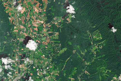
Landslides in Japan
On Sept. 6, 2018, shortly after the remnants of Typhoon Jebi drenched southern Hokkaido, a powerful earthquake rattled the Japanese island. The 6.6-magnitude quake shook the surface enough to unleash hundreds of landslides.
The Landsat 8 satellite acquired imagery of the widespread damage. An image acquired on Sept. 15, 2018, shows mud and debris in a hilly area east of Abira. For comparison, the previous image shows the same area on July 26, 2017.
Read more about this
Make sure to follow us on Tumblr for your regular dose of space: http://nasa.tumblr.com.
Space Radiation: Hazard of Stealth
A human journey to Mars, at first glance, offers an inexhaustible amount of complexities. To bring a mission to the Red Planet from fiction to fact, our Human Research Program has organized hazards astronauts will encounter on a continual basis into five classifications.

The first hazard of a human mission to Mars is also the most difficult to visualize because, well, space radiation is invisible to the human eye. Radiation is not only stealthy, but considered one of the most menacing of the five hazards.


Above Earth’s natural protection, radiation exposure increases cancer risk, damages the central nervous system, can alter cognitive function, reduce motor function and prompt behavioral changes. To learn what can happen above low-Earth orbit, we study how radiation affects biological samples using a ground-based research laboratory.


Exploration to the Moon and Mars will expose astronauts to five known hazards of spaceflight, including radiation. To learn more, and find out what our Human Research Program is doing to protect humans in space, check out the "Hazards of Human Spaceflight" website or check out this week’s episode of “Houston We Have a Podcast,” in which our host Gary Jordan further dives into the threat of radiation with Zarana Patel, a radiation lead scientist at the Johnson Space Center.

Make sure to follow us on Tumblr for your regular dose of space: http://nasa.tumblr.com.
Get to Know the 9 Astronauts Set to #LaunchAmerica
Our Commercial Crew Program is working with the American aerospace industry to develop and operate a new generation of spacecraft to carry astronauts to and from low-Earth orbit!
As we prepare to launch humans from American soil for the first time since the final space shuttle mission in 2011, get to know the astronauts who will fly with Boeing and SpaceX as members of our commercial crew!

Bob Behnken

Bob Behnken served as Chief of the NASA Astronaut Office from July 2012 to July 2015, where he was responsible for flight assignments, mission preparation, on-orbit support of International Space Station crews and organization of astronaut office support for future launch vehicles. Learn more about Bob.
Eric Boe
Eric Boe first dreamed of being an astronaut at age 5 after his parents woke him up to watch Neil Armstrong take his first steps onto the lunar surface. Learn more about Eric.
Josh Cassada

Josh Cassada holds a Master of Arts Degree and a Doctorate in Physics with a specialty in high energy particle physics from the University of Rochester, in Rochester, New York. He was selected as a NASA astronaut in 2013, and his first spaceflight will be as part of the Commercial Crew Program. Learn more about Josh.
Chris Ferguson

Chris Ferguson served as a Navy pilot before becoming a NASA astronaut, and was commander aboard Atlantis for the final space shuttle flight, as part of the same crew as Doug Hurley. He retired from NASA in 2011 and has been an integral part of Boeing's CST-100 Starliner program. Learn more about Chris.
Victor Glover

Victor Glover was selected as a NASA astronaut in 2013 while working as a Legislative Fellow in the United States Senate. His first spaceflight will be as part of the Commercial Crew Program. Learn more about Victor.
Mike Hopkins

Mike Hopkins was a top flight test engineer at the United States Air Force Test Pilot School. He also studied political science at the Università degli Studi di Parma in Parma, Italy, in 2005, and became a NASA astronaut in 2009. Learn more about Mike.
Doug Hurley

In 2009, Doug Hurley was one of the record-breaking 13 people living on the space station at the same time. In 2011, he served as the pilot on Atlantis during the final space shuttle mission, delivering supplies and spare parts to the International Space Station. Now, he will be one of the first people to launch from the U.S. since that last shuttle mission. Learn more about Doug.
Nicole Mann

Nicole Mann is a Naval Aviator and a test pilot in the F/A-18 Hornet. She was selected as a NASA astronaut in 2013, and her first spaceflight will be as part of the Commercial Crew Program. Learn more about Nicole.
Suni Williams

Suni Williams has completed 7 spacewalks, totaling 50 hours and 40 minutes. She’s also known for running. In April 2007, Suni ran the first marathon in space, the Boston Marathon, in 4 hours and 24 minutes. Learn more about Suni.
Boeing and SpaceX are scheduled to complete their crew flight tests in mid-2019 and April 2019, respectively. Once enabled, commercial transportation to and from the International Space Station will empower more station use, more research time and more opportunities to understand and overcome the challenges of living in space, which is critical for us to create a sustainable presence on the Moon and carry out missions deeper into the solar system, including Mars!
Make sure to follow us on Tumblr for your regular dose of space: http://nasa.tumblr.com.
Solar System: Things To Know This Week
Weather permitting, you can observe the Moon most nights, unless it's a new moon, when the lighted side of the Moon faces away from Earth. The Moon is by far the brightest object in the night sky and there's plenty to see. But this week is special...

...October 28 is International Observe the Moon Night (also known as InOMN).
Here's all you need to know to join in and celebrate:
1. One Planet. One Moon. One Night.

Everyone on Earth is invited to join the celebration by hosting or attending an InOMN event and uniting on one day each year to look at and learn about the Moon together.
2. What's Up?

October's night skies are full of sights, from the first quarter Moon on InOMN to Saturn making a cameo appearance above the Moon October 23 and 24. Watch our What's Up video for details.
3. Be Social

Hundreds of events are planned around the globe. Click the top link on this page for a handy map. You can also register your own event.
4. Don't Just Stand There

Here are some activities for enhanced Moon watching.
5. Impress Your Friends with Moon Knowledge

Download InOMN flyers and handouts, Moon maps and even some pre-made presentations. There's even a certificate to mark your participation.
6. Guide to the Face of the Moon

Almost dead center on the Earth-facing side of the Moon is the Surveyor 6 robotic spacecraft impact side. Apollo 12 and 14 are a bit to the left. And Apollo 11 - the first steps on the moon - are to the right. This retro graphic tells the whole story.
7. Moon Shots

NASA photographers have done some exceptional work capturing views of the Moon from Earth. Here are a few galleries:
You can't have a solar eclipse without the Moon.
The 2016 "Supermoon" was pretty spectacular.
The Moon gets eclipsed, too.
That IS a Moon - AND the International Space Station.
The Moon is always a great photo subject.
Some spooky shots of the 2014 "Supermoon."
And 2013.
Tips from a NASA pro for photographing the Moon.
8. Walking on the Moon

Twelve human beings walked on the face of the Moon. Here are some of the best shots from the Apollo program.
9. Moon Watch

Our Lunar Reconnaissance Orbiter is up there right now, mapping the moon and capturing some spectacular high-resolution shots.
10. Keep Exploring

Make our Moon portal your base for further lunar exploration.
Check out the full version of ‘Ten Things to Know This Week’ HERE.
Make sure to follow us on Tumblr for your regular dose of space: http://nasa.tumblr.com.
Solar System: Things to Know This Week
Our Dawn mission to the asteroid belt is no ordinary deep space expedition.
Instead of traditional chemical rockets, the spacecraft uses sophisticated ion engines for propulsion. This enabled Dawn to become the first mission to orbit not one, but two different worlds — first the giant asteroid Vesta and now the dwarf planet Ceres. Vesta and Ceres formed early in the solar system's history, and by studying them, the mission is helping scientists go back in time to the dawn of the planets. To mark a decade since Dawn was launched on Sept. 27, 2007, here are 10 things to know about this trailblazing mission.
1. Ion Engines: Not Just for Sci-Fi Anymore

Most rocket engines use chemical reactions for propulsion, which tend to be powerful but short-lived. Dawn's futuristic, hyper-efficient ion propulsion system works by using electricity to accelerate ions (charged particles) from xenon fuel to a speed seven to 10 times that of chemical engines. Ion engines accelerate the spacecraft slowly, but they're very thrifty with fuel, using just milligrams of xenon per second (about 10 ounces over 24 hours) at maximum thrust. Without its ion engines, Dawn could not have carried enough fuel to go into orbit around two different solar system bodies. Try your hand at an interactive ion engine simulation.
2. Time Capsules

Scientists have long wanted to study Vesta and Ceres up close. Vesta is a large, complex and intriguing asteroid. Ceres is the largest object in the entire asteroid belt, and was once considered a planet in its own right after it was discovered in 1801. Vesta and Ceres have significant differences, but both are thought to have formed very early in the history of the solar system, harboring clues about how planets are constructed. Learn more about Ceres and Vesta—including why we have pieces of Vesta here on Earth.
3. Portrait of a Dwarf Planet

This view of Ceres built from Dawn photos is centered on Occator Crater, home of the famous "bright spots." The image resolution is about 460 feet (140 meters) per pixel.
Take a closer look.
4. What's in a Name?
Craters on Ceres are named for agricultural deities from all over the world, and other features carry the names of agricultural festivals. Ceres itself was named after the Roman goddess of corn and harvests (that's also where the word "cereal" comes from). The International Astronomical Union recently approved 25 new Ceres feature names tied to the theme of agricultural deities. Jumi, for example, is the Latvian god of fertility of the field. Study the full-size map.
5. Landslides or Ice Slides?

Thanks to Dawn, evidence is mounting that Ceres hides a significant amount of water ice. A recent study adds to this picture, showing how ice may have shaped the variety of landslides seen on Ceres today.
6. The Lonely Mountain

Ahuna Mons, a 3-mile-high (5-kilometer-high) mountain, puzzled Ceres explorers when they first found it. It rises all alone above the surrounding plains. Now scientists think it is likely a cryovolcano — one that erupts a liquid made of volatiles such as water, instead of rock. "This is the only known example of a cryovolcano that potentially formed from a salty mud mix, and that formed in the geologically recent past," one researcher said. Learn more.
7. Shining a Light on the Bright Spots

The brightest area on Ceres, located in the mysterious Occator Crater, has the highest concentration of carbonate minerals ever seen outside Earth, according to studies from Dawn scientists. Occator is 57 miles (92 kilometers) wide, with a central pit about 6 miles (10 kilometers) wide. The dominant mineral of this bright area is sodium carbonate, a kind of salt found on Earth in hydrothermal environments. This material appears to have come from inside Ceres, and this upwelling suggests that temperatures inside Ceres are warmer than previously believed. Even more intriguingly, the results suggest that liquid water may have existed beneath the surface of Ceres in recent geological time. The salts could be remnants of an ocean, or localized bodies of water, that reached the surface and then froze millions of years ago. See more details.
8. Captain's Log
Dawn's chief engineer and mission director, Marc Rayman, provides regular dispatches about Dawn's work in the asteroid belt. Catch the latest updates here.
9. Eyes on Dawn
Another cool way to retrace Dawn's decade-long flight is to download NASA's free Eyes on the Solar System app, which uses real data to let you go to any point in the solar system, or ride along with any spacecraft, at any point in time—all in 3-D.
10. No Stamp Required

Send a postcard from one of these three sets of images that tell the story of dwarf planet Ceres, protoplanet Vesta, and the Dawn mission overall.
Make sure to follow us on Tumblr for your regular dose of space: http://nasa.tumblr.com.
-
 tritonrice liked this · 2 months ago
 -
 oo0ooo0ooo0oo liked this · 4 months ago
 -
 gueule-de-contact liked this · 8 months ago
 -
 fitriechemo liked this · 1 year ago
 -
 unabashedmoonhideout6969 reblogged this · 1 year ago
 -
unabashedmoonhideout6969 liked this · 1 year ago
-
 heraceles liked this · 1 year ago
 -
 lieseinbuch liked this · 2 years ago
 -
 mrfry01 reblogged this · 3 years ago
 -
mrfry01 liked this · 3 years ago
-
 zacum360 liked this · 3 years ago
 -
 syrupy-mushroom liked this · 4 years ago
 -
 nordic-reverie reblogged this · 4 years ago
 -
 sargeist liked this · 4 years ago
 -
 mariahsweirdfunhaus liked this · 4 years ago
 -
 iidontevenknowanymoreii reblogged this · 4 years ago
 -
iidontevenknowanymoreii liked this · 4 years ago
-
 per-spells reblogged this · 4 years ago
Explore the universe and discover our home planet with the official NASA Tumblr account
1K posts